GREENLAND
Spring: ** Summer: * Fall: * Winter: **
Independent Directions to this Site: From Highway 417 (The Queensway) take exit 138 (Eagleson/March Roads). If travelling west, the 0.6 km offramp sends you right or north onto March Road. If driving east, a 0.4 km offramp brings you to Eagleson Road, where you will turn left or north onto it and in 0.5 km join the westbound offramp traffic on March Road (it changed names as you went under the overpass). Both groups will now follow March Road northwest 8.0 km to Dunrobin Road. Turn right or north onto Dunrobin and go northwest 10.5 km to Vance's Side Road. Turn right or northeast onto Vance's and drive 3.4 km to Greenland Road. Turn left onto it and enter the Greenland segment of the route.
Ottawa River West: Ontario Route Directions: From the northwest end of Baskin's Beach Road in the Dunrobin Shore - Baskin's Beach area, return 1.2 km east along it to Vance's Side Road. Turn right or southwest onto Vance's and go 1.1 km to Torwood Road. Turn left or northwest onto Torwood and head into the Greenland segment of the route.
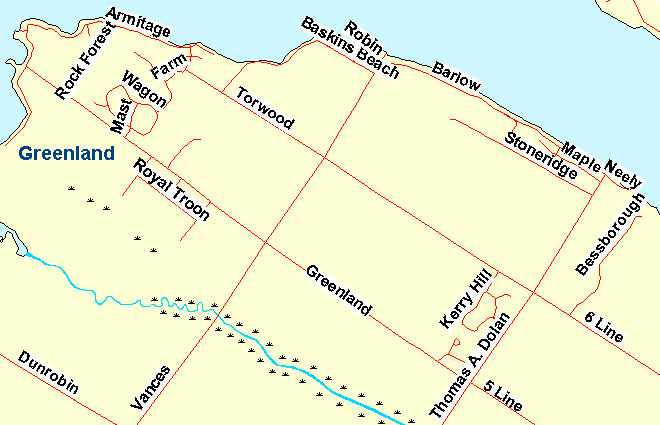 Map of the Greenland area
Site Description and Birding Information: This area can be done as a 7.8 km loop, following Torwood Road to Armtage Road and return to Vance's Side Road via Greenland Road. Armtage Road and its southwestern extention, Ironwood Road, are lined with cottages some of which have feeders. The northeast end of Greenland Road provides a good view of the Ottawa River. A Red-bellied Woodpecker was found at the Ottawa River end of Greenland Road on Nov. 5-6, 2009. A half kilometer from the end of Greenland Road, Rock Forest Road cut across the woods to Armtage Road. This road has a excellent feeding station near the Armtage end. Pileated Woodpecker workings are common.
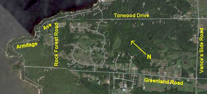 Google Satellite View of the Greenland Area
Ottawa River West: Ontario Route Directions: From the Greenland area, proceed southeast on Greenland Road to Vance's Side Road. Turn right or southwest onto Vance's and go 1.2 km to park near the bridge over Constance Creek. This is the next site, Constance Creek at Vance's Side Road.
Return to Ottawa River West: Ontario.
Return to Birding Ottawa Table of Contents.
|