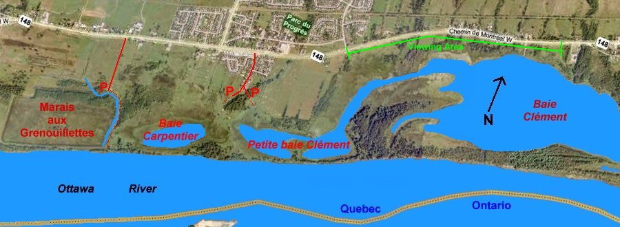
BAIE CLÉMENT
Spring: ** Summer: ** Fall: ** Winter: *
Independent Directions to this Site: Going north on Autoroute de la Gatineau or Highway 5 take Exit # 2, the Autoroute 50 east exit. Follow the long, 1.0 km, ramp over Brewery Creek and onto Autoroute 50 headed north. Proceed 22.5 km to exit 159, taking the Rue des Laurentides exit. Follow the 0.3 km exit to it and turn right or south. Go 1.0 km south to Chemin de Montréal Ouest or Highway 148. Turn left or ENE onto it and drive 2.1 km to Rue de la Forteresse. Views of Baie Clément are possible for the next kilometre or so.
Ottawa River East: Quebec Route Directions: From the parking area for Baie Carpentier and Petite Baie Clément return north on Rue du Ruisseau to Chemin de Montréal Ouest or Highway 148. Turn right or ENE on Chemin de Montréal Ouest or Highway 148 and go 1.8 km to Rue de la Forteresse. Views of Baie Clément are possible for the next kilometre or so.
 MS Virtual Earth Satellite Map of Baie Clément Area
Site Description and Birding Information: Various overlooks of the bay may be had from Highway 148. (Opposite Chemin de Montréal Ouest numbers 9225 to 831, 655 to 641, 531 and 465. The paved shoulder is wide enough here to pull completely off the highway. This site is part of the recent initiative of Quebec Parks and Wildlife, Ducks Unlimited and the North American Waterfowl Management Plan. They indicate a public access to Baie Clément on their maps but it is not yet in evidence on the ground. The only approaches visible seem to be through private land. Please ask permission.
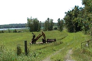 View of Baie Clément
Ottawa River East: Quebec Route Directions: From the last view of Baie Clément, about 1 km ENE of Rue de la Forteresse, go ENE on Chemin de Montréal Ouest or Highway 148 a further 4.3 km to the 3-prong junction at Masson. Bear right or southwest on Notre-Dame and Montréal Ouest, still 148, following this for 0.3 km to where Montréal and Chemin de la Quai split. Turn right or southeast on Quai and go 0.6 km to Chemin de la Pointe. Turn right or southwest on Pointe and drive about 1.5 km down this dirt road to the turnoff on the left or southwest to next site on this route, the Masson Sewage Lagoons.
Return to Ottawa River East: Quebec.
Return to Birding Ottawa Table of Contents.
|