FORMER CFB ROCKCLIFFE
Spring: ** Summer: * Fall: ** Winter: **
Independent Directions to this Site: From Highway 417 (The Queensway) take exit 115 (St. Laurent Boulevard). Go NNW 3.6 km to Hemlock Road and turn right or east on it. Proceed 1.3 km to Polaris Avenue and turn left or north on it into the former CFB Rockcliffe grounds.
Ottawa River West: Ontario Route Directions: From the western entrance of Beechwood Cemetery and John Macoun Marsh, turn right or northeast onto Hemlock Road, the eastern extention of Beechwood Avenue. Go 3.0 km northeast, then east, on Hemlock. You will cross St. Laurent Boulevard and pass under the Aviation Parkway. At 3.0 km turn left or north on Polaris Avenue, entering the grounds of the former CFB Rockcliffe.
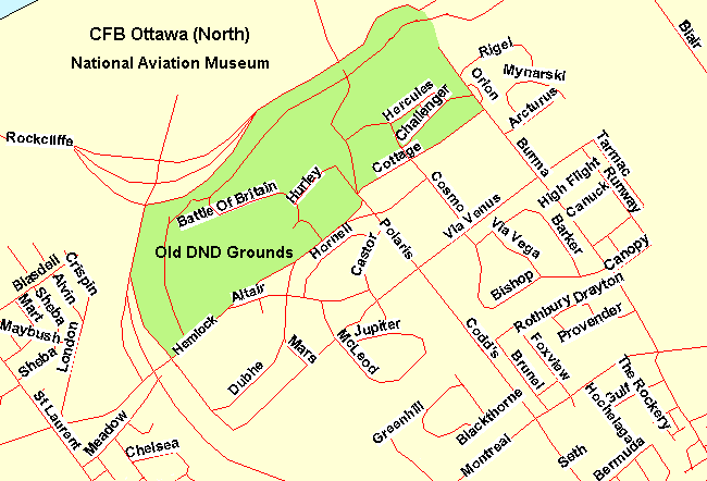 Map of Former CFB Rockcliffe Area
Site Description and Birding Information: These overgrown fields, criss-crossed with paved roads and parking lots, were formerly the site of CFB Rockcliffe. Almost the entire area between Hemlock Road on the south, the Aviation Parkway on the west, Burma Road on the east and the escarpment overlooking the Eastern Parkway and the National Aviation Museum to the north seems to have been, at least temporarily, abandoned.
The weedy, srubby fields should be excellent for sparrows in migration.
The view from the top of the escarpment is an excellent vantage for raptor watching.
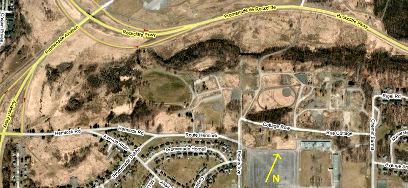 Google Satellite View of Former CFB Rockcliffe Area
Ottawa River West: Ontario Route Directions: From the former CFB Rockcliffe grounds, return via Polaris Avenue to Hemlock Road. Continue straight or SSE on Polaris, which becomes Codd's Road in 0.3 km. Continue SSE on Codd's Road for an additional 0.6 km to Montreal Road. Turn left or ENE on Montreal and drive 1.2 km to Blair Road. Turn left or NNW on it and proceed 1.6 km to an unmarked turnoff to the left just before the overpass. Turn left or west onto it and go 0.6 km to a boat launch and parking lot at our next site on this route, the Airbase Woods.
Return to Ottawa River East: Ontario.
Return to Birding Ottawa Table of Contents.
|