BLAKENEY RAPIDS PARK
Spring: ** Summer: ** Fall: ** Winter: **
Independent Directions to this Site: From Highway 417 (The Queensway) take exit 155 (March Road or Regional Road 49). Turn left or southwest onto March Road and follow it for 14.0 km to Martin Street North (Lanark 17) in Almonte. Turn right or northwest on it and drive 5.5 km to Blakeney Road at Blakeney. Turn left or west onto it and go 0.9 km to the far side of the Mississippi River bridge and the turnoff, on the left or northwest, to the Blakeney Rapids Park.
Mississippi River Valley Route Directions: From the Mill of Kintail Conservation Area, turn right or northwest on Ramsey Concession 8 and proceed 0.8 km to Bennies Corners and turn right or northeast on Bennies Corners Road. Follow this road, which becomes Blakeney Road beyond Lanark 29, for 2.3 km to the turnoff, on the left or northwest just before reaching the bridge over the Mississippi River, to the Blakeney Rapids Park.
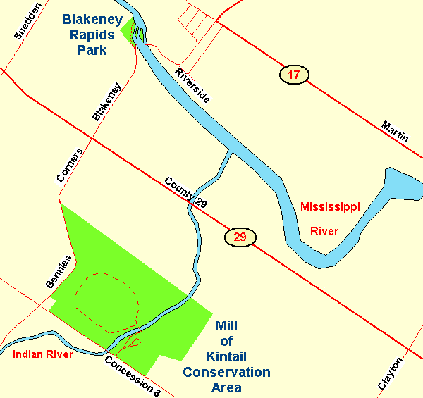 Map of the Blakeney Rapids Park
Site Description and Birding Information: This small park is surely one of the most beautiful sites along the Mississippi River. Just off the parking area is a picnic area near the bridge. The trail through the woods and along the river, though only a few hundred metres, is jam-packed with beauty and variety. Scenic woodland streams complete with footbridges, old growth conifers, rocky outcrops, rushing rapids and open river. No wonder there are so many painters and photographers working here.
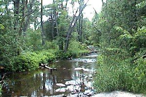 Riparian Habitat along Quiet Stream
|
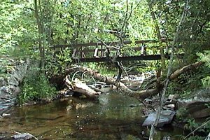 Footbridge over Stream
|
For its size, this site offers much to the birder, especially during migration. In summer, swallows can be seen hawking for insects over the river, Spotted Sandpipers bobbing along the rocky shores, Turkey Vultures sailing gracefully overhead and White-throated Sparrows heard singing their patriotic 'Oh, Canada, Canada, Canada'. It also seems to be a great spot for damselflies.
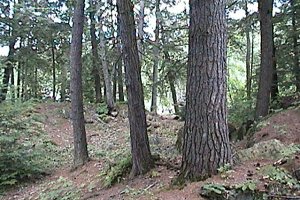 Old Conifers near the Trail's End
|
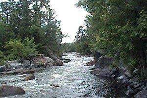 Rapid River Channel near the Trail's End
|
Mississippi River Valley Route Directions: From the Blakeney Rapids Park, turn right or east on Blakeney Road and proceed 0.9 km Martin Street North (Lanark 17) at Blakeney. Continue straight to the northeast on Blakeney Road (now Lanark 17) for 0.5 km to Ridge Road. Turn right from Lanark 17 but actually continue northeast onto Ridge Road and go 0.8 km to the turnoff, on the right or southeast, to the next site on this route, The Burnt Lands - Ramsey Concession 11B.
Return to Mississippi River Valley.
Return to Birding Ottawa Table of Contents.
|