WEST CARLETON STITTSVILLE INDUSTRIAL PARK
Spring: ** Summer: * Fall: * Winter: *
Independent Directions to this Site: From Highway 417 (The Queensway) take exit 144 (Carp Road or Regional Road 5). If driving east, a 0.6 km offramp brings you to Carp Road, where you will turn right or southeast onto it. If travelling west, the 0.5 km offramp dumps you right or west onto Carp Road, where you will turn left or southeast onto it and in 0.6 km join the eastbound offramp traffic. Both groups will now follow Carp Road southeast for 0.1 km to Westbrook Road. Turn right or southwest onto it and drive 0.3 km to Walgreen Road. Park off the side near the junction and find an obscure path to the NNW, leading into the ponds and marshes in the West Carleton Stittsville Industrial Park.
Mississippi River Valley Route Directions: From the Carp Road Landfill continue southeast along Carp Road or Regional Road 5 for 1.2 km to Westbrook Road. Turn right or southwest onto it and drive 0.3 km to Walgreen Road. Park off the side near the junction and find an obscure path to the NNW, leading into the ponds and marshes in the West Carleton Stittsville Industrial Park.
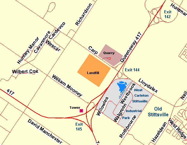 Map of the West Carleton Stittsville Industrial Park area
Site Description and Birding Information: This is another example of "unusable" land being left in a somewhat natural state. This corner of the industrial park is too wet for development, so a small marsh and ponds remain. These can be viewed from what appears to be a disused railbed that parallels Westbrook Road. To reach the main path, cut across on the easily missed path near the corner of Westbrook and Walgreen. The main path this reaches will goes left or southwest along the marsh and right or northeast through thickets and scrub toward Carp Road.
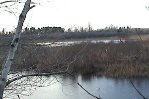
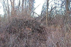 Views of the West Carleton Stittsville Industrial Park Marsh Area
Mississippi River Valley Route Directions: From the corner of Westbrook and Walgreen Roads in the West Carleton Stittsville Industrial Park, return the 0.3 km northeast to Carp Road. Turn right or southeast on Carp Road or Regional Road 5 and go 2.2 km to Stittsville Main Street North. Turn right or southeast onto it and drive 2.6 km to Fernbank Road. Turn right or southwest onto Fernbank and proceed 3.2 km to the next site on this loop, the Fernbank Road Trail.
Return to Mississippi River Valley.
Return to Birding Ottawa Table of Contents.
|