MISSISSIPPI RIVER AT HIGHWAY 17
Spring: ** Summer: * Fall: ** Winter: *
Independent Directions to this Site: From the Highway 417 (The Queensway), take Exit 169 (Kinburn Side Road) and drive northeast 0.6 km to old Highway 17 at Antrim. Turn left or northwest on old Highway 17 and go 3.1 km to the Mississippi River.
Mississippi River Valley Route Directions: From the northern end of the Loggers Way section of the Carp River at Kinburn, return northwest on Loggers Way to Hunt Line Road and travel 4.3 km to old Highway 17, just southeast of the Mississippi River bridge. Turn right onto 17 and park safely off on the side near the bridge, which is 0.3 km from Hunt Line Road.
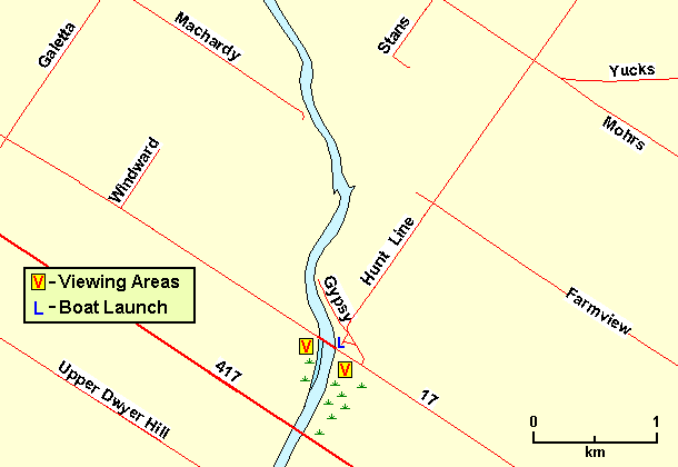 Map of the Mississippi River at Highway 17 area
Site Description and Birding Information: The traffic makes this site less pleasurable than it could be, but that may lessen dramatically when the nearby section of Highway 417 opens (fall 2004?). Southeast of the river, southwest of the bridge, there are extensive cattail marshes, with there concomitant species. On the northwest side of the river, opposite those marshes, are less extensive marshes, which feature a finger of water along the shore favoured by herons. In spring, swallows of several species can be seen here in numbers.
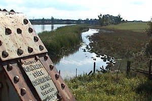 Marsh SW of Mississippi River Bridge
This section of the Mississippi River is wonderful for canoeing, which often provides a unique birding experience. There is a boat launch, just northeast of the bridge, accessible from a short dirt road 0.2 km back along Hunt Line Road. The road has a bad wet spot in season, and I don't know the "official" status of this boat launch. Use at your own discretion.
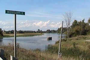 Mississippi River to the NE of Bridge
Mississippi River Valley Route Directions: From the Mississippi River at old Highway 17, return southeast on old Highway 17 driving about 3.5 km to the fields just southeast of Antrim, our next site.
Return to Mississippi River Valley.
Return to Birding Ottawa Table of Contents.
|