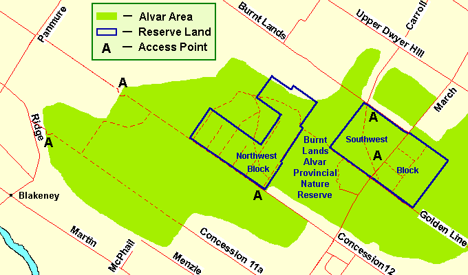
THE BURNT LANDS - RAMSEY CONCESSION 12 NORTH
Spring: *** Summer: ** Fall: ** Winter: **
Independent Directions to this Site: From Highway 417 (The Queensway) take exit 155 (March Road or Regional Road 49). Turn left or southwest onto March Road and follow it for 14.0 km to Martin Street North (Lanark 17) in Almonte. Turn right or northwest on it and drive 5.5 km to Blakeney Road at Blakeney. Turn right or northeast onto it, following Lanark 17, and go 0.5 km to Ridge Road. Turn left or northwest, continuing on Lanark 17 for 1.7 km to Panmure Road. Turn right or northeast, continuing on Lanark 17 for 1.3 km to Ridge Road. Leaving Lanark 17 and continuing straight on Panmure Road proceed a further 1.2 km to Ramsey Concession 12. Turn right or southeast into to The Burnt Lands - Ramsey Concession 12 North site.
Mississippi River Valley Route Directions: From The Burnt Lands - Ramsey Concession 11B, return northwest to Ridge Road and turn right or north onto it. Proceed 1.2 km to Panmure Road and turn right or northeast onto it. Drive 1.2 km to Ramsey Concession 12. Turn right or southeast into to The Burnt Lands - Ramsey Concession 12 North site.
 Map of the Burnt Lands area
Site Description and Birding Information: The "maintained" portion of this dirt road travels through 1.8 km of farmland. Watch for Northern Harrier, Vesper Sparrow, Bobolink, Eastern Meadowlark and other field birds along this stretch. A Loggerhead Shrike was seen here on June 29, 1991. Beyond the drainage ditch the road is posted "This is not an assumed municipal roadway. This roadway is not up to municipal standards. Entry is at your own risk." This track is best walked, in fact unless you have a 4-wheel drive, you'd probably tear the bottom out of your vehicle. The area around the ditch, at the base of the escarpment, has had Black-billed Cuckoo and Indigo Bunting.
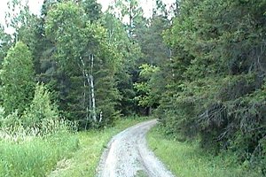 Dirt Track Going Up onto the Alvar
|
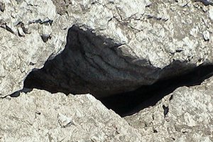 Be Careful Where You Walk
|
A good variety of wooded and open alvar land make this an interesting site to explore. It makes a good route into The Burnt Lands north end. If you continue southeast along the Ramsey Concession 12 track, you will eventually come out to The Burnt Lands Alvar PNR - NW Block site. Cape May Warbler, Yellow-rumped Warbler and Hermit Thrush breed in the forested area, and Brown Thrasher, Field Sparrow and Rufous-sided Towhee on the alvar.
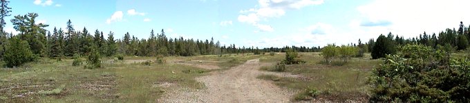 Panoramic View of the Alvar
Mississippi River Valley Route Directions: From The Burnt Lands - Ramsey Concession 12 North, return northwest to Panmure Road and turn left or southwest onto it. Proceed 0.1 km to turn right or northwest onto the next site on this route, Pakenham Concession 12.
Return to Mississippi River Valley.
Return to Birding Ottawa Table of Contents.
|