RICHMOND FEN VIA KETTLES ROAD
Spring: **** Summer: **** Fall: *** Winter:**
Warning: The Richmond Fen is accessible via the railroad tracks, and these tracks have recently been posted with warning signs. The railway right-of-way is private property, and the train is fast, quiet and deadly. That being said, authorities seem to take a benign view of birders visiting the fen. On the Richmond Fen from the North end, you might want to park well away from the rail crossing, however, or you may find yourself followed by a curious police officer looking for trouble-makers. At this site, the Richmond Fen via Kettles Road access (somewhat less walking distance) is much less likely to attract such attention and is the most frequently used way into the fen. A third alternative, though not for everyone, is the Richmond Fen via Joy's Road canoe-only access route. This may allow access without infringing on the railway property, depending on beaver dams and the like.
Independent Directions to this Site: From Highway 416 take exit 66 (Fallowfield Road). If southbound, a 0.4 km offramp dumps onto Fallowfield, where you will turn right or west. If northbound, the 0.4 km offramp brings you to Fallowfield, where you will turn left or west onto it and in 0.5 km join the southbound offramp traffic. Both groups will now follow Fallowfield Road west 16.5 km to reach Munster Road. Turn left or southeast onto Munster Road and drive 10.0 km to Kettles Road. Turn left or northeast onto Kettles and proceed 1.0 km to the pulloff on the right or southeast for the Ruffed Grouse Area on Kettles Road area. This pulloff is as good a place to park for the Richmond Fen via Kettles Road area, as any. You might save 300 metres of walking by parking at the end of Kettles (another 0.5 km) and cutting across to the tracks, but the route to the tracks is longer (250 metres), unmarked and hard to find here, especially in the dark. Better to cross the open field the shorter distance (30 metres) to the tracks from the Ruffed Grouse Area pulloff and walk the extra 300 metres.
Marlborough Forest Loop Route Directions: The pulloff for the Ruffed Grouse Area on Kettles Road is as good a place to park for the Richmond Fen via Kettles Road area, as any. You might save 300 metres of walking by parking at the end of Kettles (another 0.5 km) and cutting across to the tracks, but the route to the tracks is longer (250 metres), unmarked and hard to find here, especially in the dark. Better to cross the open field the shorter distance (30 metres) to the tracks from the Ruffed Grouse Area pulloff and walk the extra 300 metres.
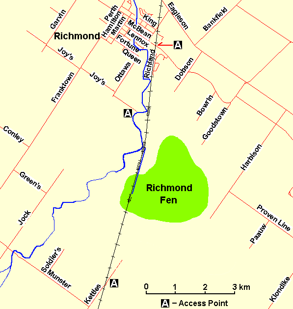 Map of the Richmond Fen Area
Site Description and Birding Information: It is 7.8 km northeast along the tracks to the entrance of the Richmond Fen from the North site on McBean Street in Richmond. The Fen itself is near the centre, but somewhat closer to this end, hence only around 6.8 km return. From the Ruffed Grouse Area pulloff, the tracks are visible (even with flashlight at night) and only a short walk across an open field. Make sure you have water and a light.
The Richmond Fen is a "must" pilgrimage for birders in the Ottawa area. It is a unique and significant wetland and is home to the only known breeding colony of Yellow Rail in our area. The hike, along the tracks, into the fen is around 3.4 km. It passes through mixed, and often wet, woodland with good visibility from the rail bed. These woods are prime owling territory. A Great Horned Owl has sometimes nested in one of the large pines, while Northern Saw-whet Owl has often been heard and seen along the tracks here. Barred and Long-eared Owls have also been heard.
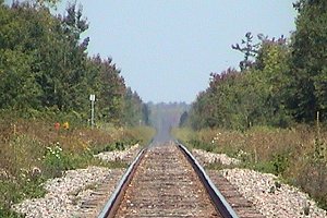 The Tracks to Richmond Fen via Kettles Road
The woodland edge along the tracks can be very birdy during migration. Watch closely when you are leaving the woodland and entering the fen (around 3 km), this transition habitat is often very productive. It is a great place to find boreal forest migrants such as Canada (who breed) and Blackpoll Warbler or Yellow-bellied Flycatcher.
A bit farther along, between the 15 and 15.25 markers, is the heart of the fen, where Yellow Rails (up to 10 ticking in exceptional years) and Sedge Wrens (up to 30 singing in exceptional years) hold forth in May and June. American and Least Bittern, Northern Harrier, Virginia Rail, Sora, Marsh Wren, Alder and Willow Flycatcher and Swamp Sparrow are breeders here. Rarities that have shown up here include: Sharp-tailed Sparrow (Jun. 12, 1993). Walking in by daylight, staying until after dark, then walking out is one strategy. Another is to walk in the early morning darkness, then walk out catching the dawn chorus. Big Day listers often walk in before midnight, tick off the night birds and rush out and off to their next site.
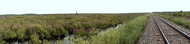 View of the Richmond Fen
Another access, albeit very wet, is the track leading off to the northeast from the end of Kettles Road (0.5 km beyound the Ruffed Grouse Area). This trail extends 5.2 km to emerge at the Goodstown Road site. The central part of this track may not be passable if water levels are high.
Marlborough Forest Loop Route Directions: From the pulloff for the Ruffed Grouse Area, where you are parked to visit the Richmond Fen via Kettles Road area, return the 1.0 km to Munster Road. Turn right or northwest and go 6.3 km, to just beyond Copeland Road, where you can pulloff to the left or southwest on the shoulder to view parts of the next site on this loop, the Munster Sewage Lagoons.
Return to Marlborough Forest Loop
Return to Birding Ottawa Table of Contents
|