Independent Directions to this Site: This site is about 3 hours east of Ottawa on the New York - Vermont border, just south of Quebec. To reach the Lake Champlain area from Ottawa, take Highway 417 east 60 km to Highway 138 (exit 58 to Cornwall). Follow Hwy 138 SSE 32 km to Cornwall Centre Road. Turn right or WSW on it to continue on 138, go 0.7 km to Brookdale Avenue. Turn left or SSE on it to continue on 138. Follow Brookdale (138) over Highway 401 and continue straight SSE on it for 4.5 km to the traffic circle. Proceed halfway around it to continue straight on Brookdale and go 0.5 km to the split. Take the righthand lane to the international bridge and drive 1.5 km south across it to the toll booth ($2.25) on Cornwall Island. A further 1.1 km south brings you to the Canadian customs station (passport needed). (* Note: Remember to have your telescopes, binoculars and cameras registered at Canadian customs before crossing the border. This eliminates any hassles re duty upon reentry.)
One kilometre further south on the same road, across the bridge, brings you to the United States customs station on the American side of the St. Lawrence River. Once cleared by customs, you will go 0.4 km SSW to the traffic circle. About 0.5 km around it, take the 3rd exit to the right (for Highway 37 east/north). Follow Hwy 37 for 30 km (18.5 mi) east through Fort Covington to Westville Center, NY and Route 122. Turn left or east onto 122 and follow it 16.5 km (10 mi) to Highway 11, west of Burke Center, NY. Turn left or east on 11 and drive 64.3 km (40 mi) to Interstate 87 at Champlain.
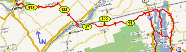
From here you can head south on I87 along the NY shore of Lake Champlain or continue east 7.6 km (4.7 mi) to the lakeshore at Rouses Point, NY to access the Vermont portions of the lake. A short 1.9 km (1.2 mi) north along the lakeshore on 11 through the village of Rouses Point brings you to US Route 2 (a short distance south of the Canadian border crossing). Turn right or east on Route 2 and go 11.4 km (7.1 mi) to Alburgh Center and the Route 78 turnoff. Here you may continue south through the islands in Lake Champlain on Route 2 or turn left onto Route 78 and travel down the east side of the lake.
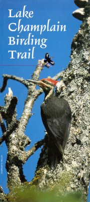
Site Description and Birding Information: This beautiful lake and its immediate surroundings have such potential as a birding area that the route around the lake has been designated a birding trail. A beautiful brouchure and map describes the sites along the way. See their website for more information.
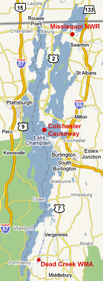
One of the best areas to bird is the Dead Creek WMA near Addison, VT where thousands of Snow Geese gather each fall. A viewing area has been provided right on Route 17 west of Addison. The rutted dirt road south off 17 into the Brilyea Access brings one to excellent waterfowl and shorebird habitat with many trails.
Charlotte Town Beach is one of the more productive spots along the lakeshore south of Burlington, VT. It was here that the Black-tailed Gull was seen in 2005. Less regular waterfowl and gulls, as well as jaegers have been seen from here.
The Colchester Causeway east of Burlington, VT is another great spot for lake watching. Again less regular waterfowl and gulls, as well as jaegers have been seen from here. A Northern Wheatear was present for a week or so in Sep. 2006. It exists because it was formerly part of the rail line between Grand Isle and Burlington. It can be approached from either end (both are good) and allows access out into the lake a fair distance on each end, 1 km from the north and 1.5 from the south.
Missisquoi NWR is a great spot for marsh and woodland birds. It is found along Route 78, northeast of Swanton, VT, just south of the Canadian border.
Recent rare birds reported from Lake Champlain include Black-tailed Gull (Nov. 2005), Northern Wheatear (Sep. 2006).
|