RÉSERVE FAUNIQUE DE LA VÉRENDRYE WILDLIFE RESERVE
Spring: ** Summer: ** Fall: ** Winter: **
Independent Directions to this Site: From Ottawa take the MacDonald-Cartier Bridge to Hull and Highway 5. Follow Highway 5 north for 27.3 km until it ends. Then turn left or north on Highway 105 and continue 135 km to Highway 117 at Grand-Remous. Turn left or NW on 117 and proceed 21.4 km to Réserve faunique de La Vérendrye Wildlife Reserve.
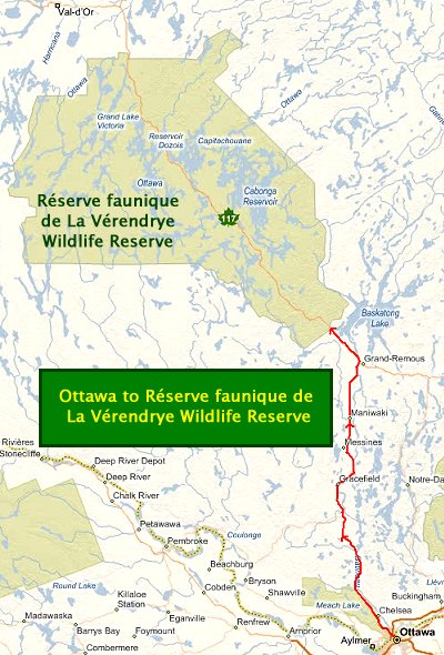 Ottawa to Réserve faunique de La Vérendrye Wildlife Reserve Route Map
(MS Virtual Earth Maps)
Site Description and Birding Information: The La Vérendrye Wildlife Reserve (Réserve faunique de La Vérendrye) is 145 to 300 km NNW of Ottawa, as the crow flies; but will take 3 hours to get to the closest point by car. It was set aside in 1939 mainly as a hunting and fishing preserve, with camping. It is heavily used for these purposes, although canoeing, skiing and even wildlife viewing are becoming more acceptable these days. It consists of over 13,000 square kilometres of largely coniferous forest. There are an abundance of lakes and streams and rivers in the reserve, including several large lakes. Cabonga and Dozios Reservoirs are the largest of these.
Boreal forest species are easily found here, many breeding. Gray Jay, Boreal Chickadee and Spruce Grouse are found year round. Nearly 20 species of wood warblers nest in the reserve, including Tennessee, Cape May, Magnolia, Blackburnian and Canada Warblers and Northern Parula. Olive-sided and Yellow-bellied Flycatchers also breed here, as do Black-backed Woodpecker and Rusty Blackbird. Common Terns nest in the largeer lakes.
For an internet link to obtain more information, click here.
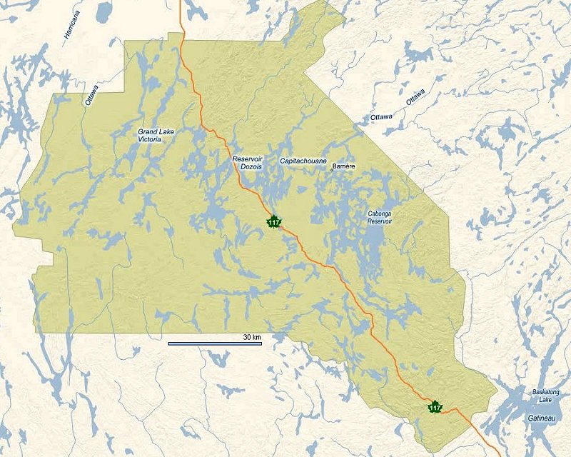 Réserve faunique de La Vérendrye Wildlife Reserve Route Map (MS Virtual Earth Maps)
(to view the satellite image of the area move your cursor over the map)
Return to Favourite Outlying Sites.
Return to Birding Ottawa Table of Contents.
Copyright © 2000 - 2009 Larry E. Neily
Last update: October 25, 2009
|