COBBS LAKE CREEK at DU LAC ROAD
Spring: *** Summer: * Fall: ** Winter: *
Independent Directions to this Site: From Highway 417 (The Queensway) take exit 96 (Boundary Road). Proceed 2.0 km NNW on Boundary Road to Russell Road (Regional 26). Turn right or ESE onto Russell and drive 25.4 km to Champlain Road (Regional 8) in Bourget. Turn left or NNW on it and proceed 6.2 km to St. Pascal Road. Turn right or ENE onto St. Pascal Road and go 2.8 km to Du Lac Road and turn right or SSE onto it. Proceed SSE along Du Lac 1.2 km to Maisonneuve Road. Continue straight SSE on Du Lac to the flooded area of Du Lac Road at the Cobbs Lake Creek floodplain.
Spring Flooding Route Route Directions: From Cobbs Lake Creek at Pilon Road, return the 0.3 km to St. Pascal Road and turn right or ENE onto it. Drive 1.4 km to Du Lac Road and turn right or SSE onto it. Proceed SSE along Du Lac 1.2 km to Maisonneuve Road. Continue straight SSE on Du Lac to the flooded area of Du Lac Road at the Cobbs Lake Creek floodplain.
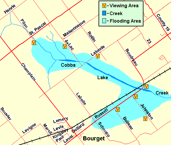 Map of Cobbs Lake Creek at Du Lac Road area
Site Description and Birding Information: This is the second in a series of spots from which to view the Cobbs Lake Creek floodplain. The road will likely be closed due to flooding and you may have to walk SSE along it to get a closer view of the birds. If it is open, the flooding will no longer be as extensive and the birds likely gone. A Tundra Swan was seen in the fields in this general area on April 9 and 11, 2007, resting and flying with a hundred or so Canada Geese.
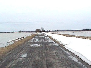 Du Lac Road Bisecting the Floodplain
|
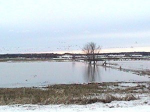 Looking West over Cobbs Lake Creek Floodplain
|
Spring Flooding Route Route Directions: From Cobbs Lake Creek at Du Lac Road, return NNW to Maisonneuve Road and turn right or ENE onto it. Drive 1.3 km to Rollin Road and turn right or SSE onto it. Proceed SSE along Rollin 1.8 km to Lalonde Road. Turn right or WSW onto Lalonde and park at the barricade at the next site on this loop, Cobbs Lake Creek at Lalonde Road.
Return to Spring Flooding Route.
Return to Birding Ottawa Table of Contents.
|