CANOE LAKE ROAD
Spring: *** Summer: *** Fall: ** Winter: *
Independent Directions to this Site: Canoe Lake Road is about 2 hours southwest of Ottawa by car. Take Highway 417 west to the Highway 7 exit (145), then take the Hwy 7 exit to the right or west. Follow it over the 417 and head south on Hwy 7. Drive 20 kilometres southwest to Carleton Place and Highway 15. Turn left or SSE on Hwy 15 and go a further 60 kilometres through Smith's Falls and Portland to Crosby and County Road 42. Turn right or west onto CR 42 and proceed 13 km to the far side of Westport and County Road 8/12. Turn left or southwest onto it and drive 11 km to the Canoe Lake Road on the left or south.
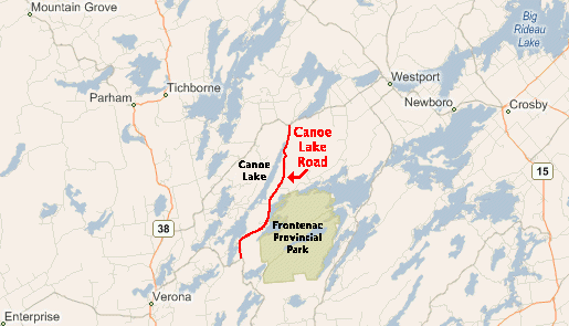 Microsoft Virtual Earth Map of Canoe Lake Road Area
Site Description and Birding Information: The northern end of this road, especially along the lakeshore, is the best birding area. The star attraction here is the breeding Louisiana Waterthrush. It is near the northern edge of its range here. The best spots are the steep creek ravines north of the campground. These birds are much easier to hear than see. Birds were found at two separate locations along the road in late April of 2007. An article in the OFO News: Vol.18-1 gives further directions. Golden-winged and Cerulean Warblers, Yellow-throated Vireos, Yellow-billed Cuckoo and Whip-poor-will are all to be found along Canoe Lake Road. Eastern Bluebird can be found along the north end of the road.
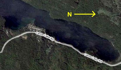 Google Map Satellite Image of the North End of Canoe Lake
Return to Favourite Outlying Sites.
Return to Birding Ottawa Table of Contents.
|