Independent Directions to this Site: From Highway 416 take exit 72 (West Hunt Club Road). If southbound, a 0.4 km offramp dumps onto West Hunt Club Road, where you will turn left or northeast and in 0.4 km turn right or SSE onto Cedarview Road. If northbound, the 0.2 km offramp brings you to Cedarview Road, where you will turn right or SSE onto it and in 0.2 km cross West Hunt Club and join the southbound traffic. Both groups will now follow Cedarview Road SSE for an additional 2.0 km to reach a road on the right which passes over Highway 416 to the west to reach the parking area for The Log Farm (about 0.4 km). Watch for Log Farm signage. If you reach Lytle Avenue, you have passed this road by 150 metres.
Stony Swamp Loop Route Directions: From from the Bruce Pit Trails parking area, go left or SSE onto Cedarview Road and drive 3.6 km, passing West Hunt Club Road to reach a road on the right which passes over Highway 416 to the west to reach the parking area for The Log Farm (about 0.4 km). Watch for Log Farm signage. If you reach Lytle Avenue, you have passed this road by 150 metres.

Site Description and Birding Information: There are several trails meandering through various stages of field and woodland to the west and north of the parking area. A large pond lies to the northwest as well; and a large marsh is directly west of the parking area. These trails join up with the outer loop of the Jack Pine Trail and trail # 26 at the West Hunt Club Road Trails site. The trails here are not on the Greenbelt Trail Map. These trails go through a good variety of habitats.
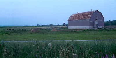
An interpretive centre exists here for the Log Farm historical site, a restored 1870's farmstead. Visitors are encouraged to observe and participate in the simple activities of pioneer life in this living history farm. Note: The access road is gated when the Log Farm is closed.
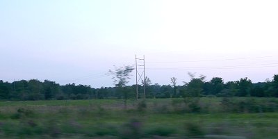
When coming and going, check the fields to the east of Cedarview for geese in spring and fall. A Greater White-fronted Goose hung out with the Canada Geese here from Oct. 29 to Dec. 3, 1988.
Stony Swamp Loop Route Directions: From the Log Farm parking area, return the 0.4 km eastward across Highway 416 to Cedarview Road. Turn left or NNW onto it and proceed 2.0 km to West Hunt Club Road. Turn left or southwest on it and drive 1.6 km to reach parking area P11 on the left for the next location on this loop, the West Hunt Club Road Trails.