W.A. TAYLOR CONSERVATION AREA
Spring: ** Summer: ** Fall: ** Winter: **
Independent Directions to this Site: From Highway 416 take exit 49 (Roger Stevens Drive). Go northeast on Roger Stevens or Regional 6 for 4.0 km to River Road or Regional 19, just across the Rideau River bridge. Turn right or SSW onto River Road and go 3.2 km to Osgoode Main Street. Turn right or southwest onto it and almost immediately (0.1 km) turn right or northwest into the parking lot for the W.A. Taylor Conservation Area.
Rideau River East Side Route Directions: From the junction of Shylo Crescent and Rideau Forest Drive, the beginning of a short loop through Rideau Forest subdivision, return west 1.4 km on Rideau Forest Drive to River Road or Regional 19. Turn left or south onto it and proceed 9.8 km to Osgoode Main Street. Turn right or southwest onto it and almost immediately (0.1 km) turn right or northwest into the parking lot for the W.A. Taylor Conservation Area.
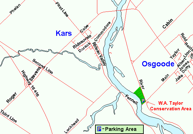 Map of the W.A. Taylor Conservation Area
Site Description and Birding Information: The Rideau Valley Conservation Authority has "developed" (honest, their word) this strange combination of picnic park, boat launch and considerably groomed "conservation area", located between River Road and the Rideau River just west of Osgoode, calling it the W. A. Taylor Conservation Area. The southern part of this area is given over to parking, lawns with large trees, picnicing, and a boat launch area. The more northerly portions of the park, bounded by a lovely little creek and reachable via a wooden footbridge, have a small section of field habitat and a larger wooded area. These woods have curiously regular wide trails running the length from the river to the road. This provides excellent viewing opportunities. Should be good during migrations.
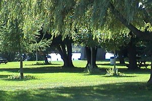 View of W. A. Taylor Conservation Area
|
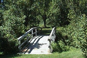 Footbridge at W. A. Taylor Conservation Area
|
Rideau River East Side Route Directions: From the parking lot for the W.A. Taylor Conservation Area, return to Osgoode Main Street and turn left or northeast on it and return the 0.1 km to River Road or Regional 19. Turn right or southeast onto it and proceed 2.6 km to the turnoff on the northwest or sharp right back into the next site on this route, Gideon Adams Park.
Return to Rideau River East Side.
Return to Birding Ottawa Table of Contents.
|