PINECREST CEMETERY
Spring: ** Summer: * Fall: * Winter:**
Independent Directions to this Site: From Highway 417 (The Queensway) take exit 129 (Greenbank Road) south. Go SSE for 1.0 km on Greenbank to Baseline Road. Turn left or ENE onto Baseline and proceed 0.3 km to the turnoff on the right or southeast into the Pinecrest Cemetery.
Ottawa West Park Loop Route Directions: From where you are parked along Parkview Crescent for exploration of the Crestview Greenspace, return the 0.2 km west to Viewmount Drive and turn left or west onto it. Drive 0.7 km to Meadowlands Drive West and turn left or WSW onto it. Go 0.7 km on Meadowlands to Woodroffe Avenue and turn right or north onto it. Drive 1.1 km to Baseline Road and turn left or WSW onto it. Proceed 2.0 km to the entrance on the left to the Pinecrest Cemetery.
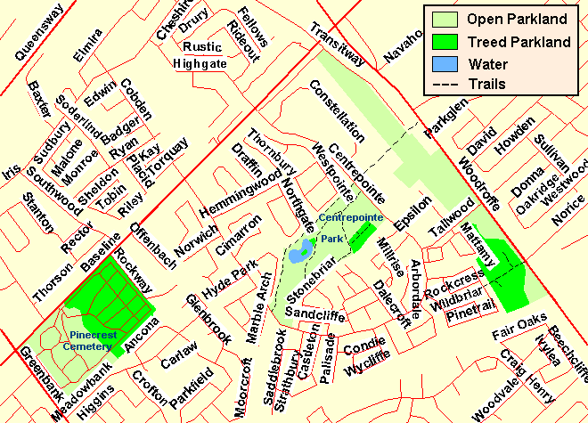 Map of the Pinecrest Cemetery Area
Site Description and Birding Information: This cemetery has been a favourite spot for in-city birding for many years. Because of all the mature trees in the eastern half of the graveyard, many birds find this an attractive stop on migration. Because of the pines in the northeast corner, it is worth checking in winter for finches. The more open western section is not as attractive birdwise. The interface, however, may harbour flycatchers and such during migration.
Two Carolina Wrens were present for at least two weeks in mid-September 2002, in the Meadowbank Drive and Crofton Road area on the southern boundary of the Pinecrest Cemetery.
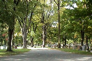
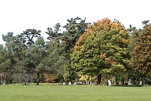 Views of the Pinecrest Cemetery
Ottawa West Park Loop Route Directions: From the Pinecrest Cemetery, return to Baseline Road and turn left or southwest onto it. Go 0.3 km to Greenbank Road and turn right or north onto it. Proceed north 1.6 km on Greenbank to Harwood Avenue. Turn right or east onto Harwood and proceed 0.1 km to Pinewood Crescent. Turn right or south onto Pinewood and follow it around (east, then north) 0.5 km to Henley Street. Turn right or east onto Henley and drive 0.3 km to a small parking area on the right at the entrance to the trails for the next site in this loop, the Frank Ryan Park.
Return to Ottawa West Park Loop
Return to Birding Ottawa Table of Contents
|