PETRIE ISLANDS
Spring: *** Summer: ** Fall: ** Winter: *
Independent Directions to this Site: From Highway 417 (The Queensway) take exit 113 (Ottawa-Carleton 174, formerly Highway 17). Stay in the left lanes to take this exit. Go WNW 14.2 km to the Petrie Islands exit, Trim Road. Turn left or NNW on it and go 0.7 km to the causeway to Petrie Islands.
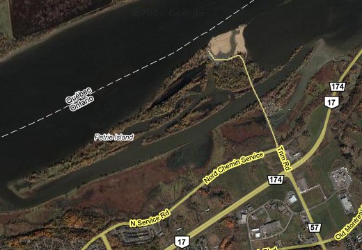 Google Satellite Map of Petrie Islands
Ottawa River West: Ontario Route Directions: From the Teal Cove Marshes return to your car at the north end of Champlain Street. Return SSE 0.5 km on Champlain to Jeanne d'Arc Boulevard North. Turn left or ENE onto it and follow it 1.4 km to New 10th Line Road, where Jeanne d'Arc's eastward extension becomes North Service Road. Continue straight or northeast another 2.0 km to Trim Road. Turn left or NNW onto Trim and go 0.5 km to the causeway to Petrie Islands.
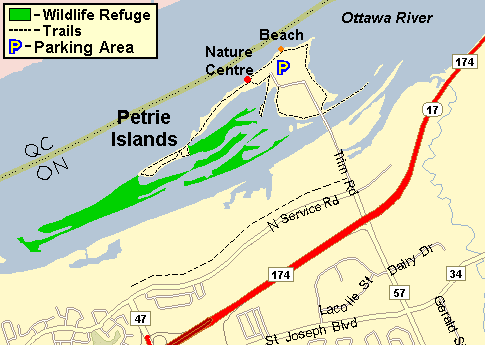 Map of Petrie Islands
Site Description and Birding Information: This complex of islands, one main and several small ones, has much to recommend it. There are many sheltered channels, marshy areas, and plenty of woodland with lots of trails. The trails are mostly maintained by the constant tramp of fishermen, but are no less useful to birders. About 0.4 km beyond the causeway, where there used to be a gravel quarry at the northeastern end of the main island, there is now a parking lot for beach goers and hikers. A nature centre and picnic area are found west of the parking area along the river. The trails, picnic area and nature centre are maintained by the Friends of Petrie Island. There are 5 km of easy walking paths on the islands, as well as the 2 km long North Service Road trail that parallels that roadway. Park off to the side by the causeway or at the parking area for the nature trails and beach. A canoe would add scope to your opportunities here and can be lauched from the causeway area.
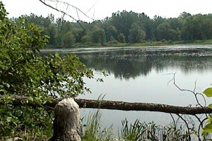
 Looking West from the Trim Road Causeway
|
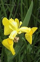 Yellow Iris West of Causeway
|
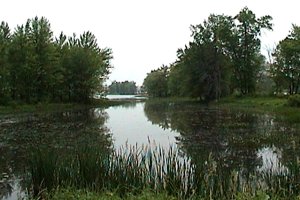 Looking East from the Trim Road Causeway
|
In the invasion winter of 2004 - 05, several Great Gray Owls were seen on the islands and along the North Service Road, opposite the islands.
This site is especially good during migration. Many good birds have turned up over the years. In summer, watch (or rather listen) for breeding marsh birds, including Virginia Rail, Sore, Black Tern and the scarce Least Bittern. In the fall Nelson's Sparrow has been seen at the south end of the causeway (Oct. 11, 2011). See also the Petrie Island website.
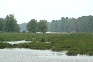
 Looking South over Turtle Pond
|
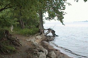 Tornado Trail along Ottawa River
|
Ottawa River West: Ontario Route Directions: Return to the causeway across to Petrie Islands on Trim Road and return the additional 0.7 km to the main highway, 174 to the west, 17 to the east. Turn left or northeast onto Highway 17 and proceed 9.5 km to Kinsella Drive. Turn right or south onto this 0.1 km joining road and then turn left or west onto Old Montreal Road. Follow it 1.4 km to Becketts Creek Road and turn right or south onto it. Go 1.4 km to a T-jucntion and take a left where it say "Becketts Creek Road continues". Follow it west, then southwest for 0.4 km and then turn left or WNW onto Wilhaven Drive. In about 0.6 km you will begin to see the CWS signs posted on the left. This is the next site, Becketts Creek National Bird Sanctuary.
Return to Ottawa River East: Ontario.
Return to Birding Ottawa Table of Contents.
|