WENDOVER
Spring: ** Summer: * Fall: *** Winter: *
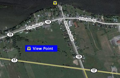
Independent Directions to this Site: From Highway 417 (The Queensway) take exit 113 (Ottawa-Carleton 174, formerly Highway 17). Stay in the left lanes to take this exit. Go WNW 14.2 km to the Petrie Islands turnoff, Trim Road, where the 4-lane divided highway is reduced to 2 lane, 2 way traffic and beyond which the road is still called Highway 17 (outside the Ottawa-Carleton boundary). Continue straight northwest for an additional 30.8 km to Wendover and Regional 19. Turn left or NNW on 19 and drive 1.0 km to the Ottawa River at Wendover.
Ottawa River West: Ontario Route Directions: From Rockland Sewage Lagoons, return to Highway 17 and turn left or east on it. Continue 13.0 km east to Wendover and Regional 19. Turn left or NNW on 19 and drive 1.0 km to the Ottawa River at Wendover.
 Google Satellite Map of Wendover
Site Description and Birding Information: This community is directly opposite Baie Noire along the Ottawa River and it is worth checking the river from here during waterfowl migrations.
Ottawa River West: Ontario Route Directions: This is the last site on this linear tour, but you can branch out from here to another of the southeastern loops or take the ferry to Thurso and return to Ottawa via the Ottawa River East: Quebec linear tour. The Thurso ferry is about 9 kilometres west of Wendover.
Return to Ottawa River East: Ontario.
Return to Birding Ottawa Table of Contents.
|