WEST END OF HARMONY ROAD
Spring: ** Summer: ** Fall: ** Winter: **
Independent Directions to this Site: From Highway 417 take exit 96 (Regional 41 or Boundary Road) and go SSE on 41 for 15.9 km to the Marvelville Road at Marvelville. Turn right or southwest onto it and go 8.7 km to Highway 31. Turn left or SSE onto 31 and proceed 5.6 km to Harmony Road. Turn right or southwest onto it and drive 2.1 km to the end of the gravel portion of Harmony. This is the access to the area at West End of Harmony Road.
South Gower / Mountain Loop Directions: From the West End of Armstrong Road return 1.6 km northeast to Merkley Road. Turn left or northwest onto it and drive 1.5 km to Harmony Road. Turn left or southwest onto it and proceed 1.3 km to the end of the gravel portion of Harmony, at a large farm. This is the access to the West End of Harmony Road.
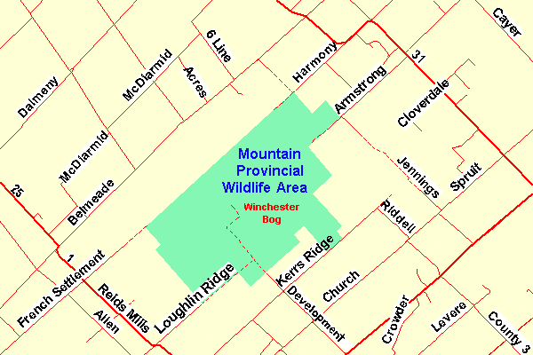 Map of the Winchester Bog Area
Site Description and Birding Information: This end of Harmony Road extends along the northwestern edge of the Mountain Provincial Wildlife Area. The dirt track passes farmland, mixed second growth, wetland and scrub habitat.
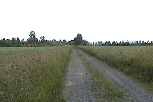 View of West End of Harmony Road
South Gower / Mountain Loop Directions: From the West End of Harmony Road return 2.1 km northeast to Highway 31. Turn left onto 31 to continue northeast, then southeast on it for 6.5 km to Licumbe Road. Turn left or ENE onto it and drive 2.3 km to the corner where Ottawa Street (County 3) joins on your right. Continue straight ENE along Liscumb Road, now also County 3, and in just less than a kilometre you will see the entrance, on the right or SSE, to the next site on this route, the Winchester Sewage Lagoons.
Return to South Gower / Mountain Loop.
Return to Birding Ottawa Table of Contents.
|