JOCK RIVER FROM CEMETERY SIDEROAD
Spring: ** Summer: *** Fall: * Winter: *
Independent Directions to this Site: From Highway 417 (The Queensway) take exit 145 (Highway 7). The offramp continues directly as Highway 7. Continue south, the southwest on Highway 7 for 18.6 km to the Derry Sideroad (County Road 17). Turn left or southeast onto it and go 2.5 km to the Jock River at Cemetery Sideroad.
Mississippi River Valley Route Directions: From the Goodwood Marsh along Derry Sideroad, continue NW on Derry for c. 3 km to the Jock River at Cemetery Sideroad.
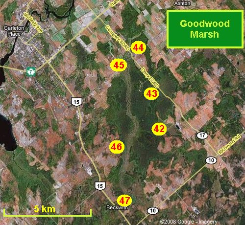 Map of the Goodwood Marsh area
Click on other site numbers to go to their pages.
Map of the Goodwood Marsh area
Click on other site numbers to go to their pages.
Site Description and Birding Information: There are views here on either side of the extensive marshland along the Jock River.
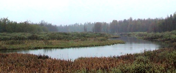 View of Jock River from Cemetery Sideroad Looking East
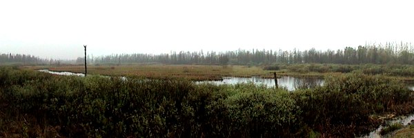 View of Jock River from Cemetery Sideroad Looking West
Mississippi River Valley Route Directions: From the Jock River at Cemetery Sideroad, return SE along Cemetery for 0.2 km to 9th Line Beckwith. Turn right or SW onto 9th Line and go 0.7 km to the next site on this route, the Jock River at 9th Line Beckwith.
Return to Mississippi River Valley.
Return to Birding Ottawa Table of Contents.
|