CREEK AT PROSPECT
Spring: ** Summer: ** Fall: * Winter: *
Independent Directions to this Site: From Highway 417 (The Queensway) take exit 145 (Highway 7). The offramp continues directly as Highway 7. Continue south, the southwest on Highway 7 for 10.5 km to the Upper Dwyer Hill Road. Turn left or southeast onto it and go 11.2 km to Franktown Road (Regional 10) at Dwyer Hill. Turn right or southwest on it and proceed 4.1 km to the Creek just SW of the town of Prospect.
Mississippi River Valley Route Directions: From the Prospect Marsh on the Franktown Road (Regional 10), go southwest on Regional 10 for 1.6 km to the Creek just SW of the town of Prospect.
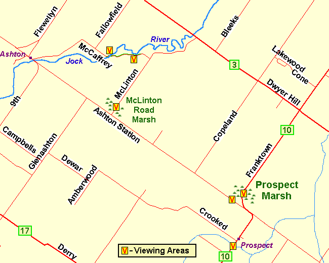 Map of the Creek at Prospect area
Site Description and Birding Information: This creek flowing out of the Goodwood Marsh to Kings Creek has grassy margins, bordered by willow and scrub, then surrounded by deciduous trees. This variety of habitat, combined with excellent viewing conditions (excluding traffic), make this site worth a quick check en passant.
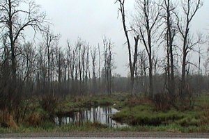 View of Creek Looking SE from Franktown Road
|
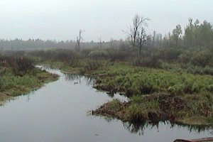 View of Creek Looking NW from Franktown Road
|
Mississippi River Valley Route Directions: From the Creek just SW of the town of Prospect on the Franktown Road (Regional 10), go southwest on Regional 10 for 3.2 km to Derry Sideroad (Regonial 17). Turn right or NW onto Derry and drive 3.0 km to Kidd Road. Turn left or SW onto Kidd and proceed c. 1 km to the next site on this route, the Goodwood Marsh from Kidd Road.
Return to Mississippi River Valley.
Return to Birding Ottawa Table of Contents.
|