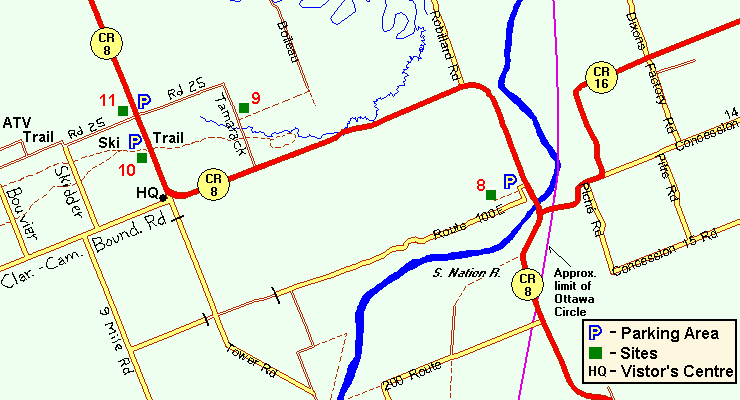
COUNTY ROAD 8 AND ROUTE 100E TRAIL
Spring: ** Summer: *** Fall: ** Winter: ***
Independent Directions to this Site: From Highway 417, 52 km east of Ottawa, take the Casselman exit (66) and go NNW toward the town of Casselman. Drive 1.1 km NNW into town on Rue Principale, crossing the railway tracks and the main cross-street (St. Isidore), to turn right or northeast just beyond onto Laurier Street. Follow Laurier northeast, then north, 1.8 km to Concession 5 Road (or Route 500). Continue straight across and follow Lemieux Road north 4.7 km to Route 200E. Turn right and go northeast on Route 200E for 2.6 km to County Road 8. Turn left or NNW on CR 8 and drive 2.1 km to the parking area on the left, just 0.2 km past the South Nation River bridge, for the County Road 8 and Route 100E Trail.
Larose Forest Loop Route Directions: From the Lemieux Road and Route 200E Trail, go northeast on Route 200E for 2.6 km to County Road 8. Turn left or NNW on CR 8 and drive 2.1 km to the parking area on the left, just 0.2 km past the South Nation River bridge, for the County Road 8 and Route 100E Trail.
 Map of County Road 8 and Route 100E Trail area
Click on other site numbers to go to their pages.
Map of County Road 8 and Route 100E Trail area
Click on other site numbers to go to their pages.
Site Description and Birding Information: This trail, heading southwest from the parking area, goes through a mature woodland area that has some good stands of pine. The area can be quite wet, so boots are recommended. Insects can be bothersome.
In the summer of 2005, a pair of Northern Goshawks nested in this area. Goshawks often nest in the same tree for several years, so be alert. Should you stumble across their nest tree, be prepared to fend off aggresive attacks. A conifer branch held over your head will give an alternate target.
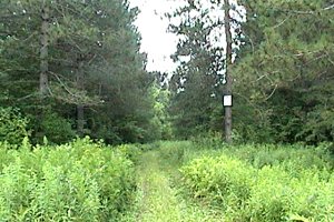 County Road 8 and Route 100E Trailhead
|
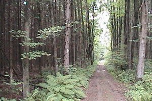 Pines along County Road 8 and Route 100E Trail
|
Route 100E, a dirt road, continues beyond the parking area, bending southwest to parallel the trail. Good views of the pine forest can be had from this section of the roadway.
Larose Forest Loop Directions: From the trail at County Road 8 and Route 100E, go NNW, then southwest, on County Road 8 for 5.4 km to Tamarack Road. Turn right or NNW into the next site on this route, the Tamarack Road.
Return to Larose Forest Loop.
Return to Birding Ottawa Table of Contents.
|