ROUTE 300E TRAIL
Spring: ** Summer: ** Fall: ** Winter: *
Independent Directions to this Site: From Highway 417, 52 km east of Ottawa, take the Casselman exit (66) and go NNW toward the town of Casselman. Drive 1.1 km NNW into town on Rue Principale, crossing the railway tracks and the main cross-street (St. Isidore), to turn right or northeast just beyond onto Laurier Street. Follow Laurier northeast, then north, 1.8 km to Concession 5 Road (or Route 500). Continue straight across and follow Lemieux Road north 3.3 km to Route 300E. Turn right or northeast on Route 300E and drive 0.5 km to the Route 300E Trail.
Larose Forest Loop Route Directions: From Lemieux Road at the Extension Trail, continue NNW on Lemieux 0.9 km to Route 300E. Turn right or northeast on Route 300E and drive 0.5 km to the Route 300E Trail.
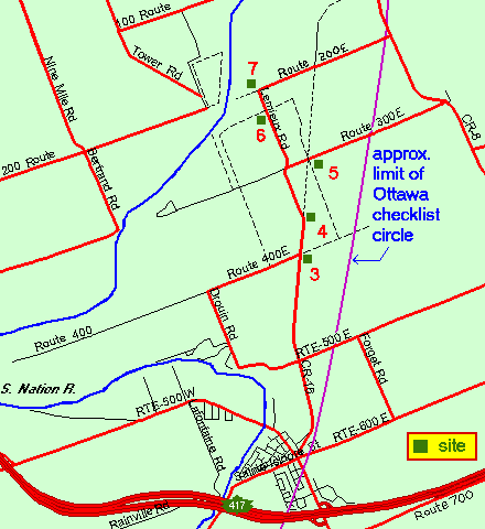 Map of Route 300E Trail area
Click on other site numbers to go to their pages.
Map of Route 300E Trail area
Click on other site numbers to go to their pages.
Site Description and Birding Information: At this point on Route 300 the snowmobile trail (site 5 on the map) crosses. Go either north or south into the mixed woodland. The area can be quite wet, so boots are recommended.
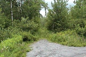 Route 300E Trail to North
|
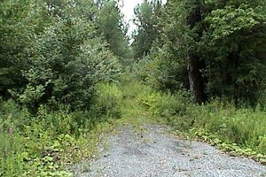 Route 300E Trail to South
|
Larose Forest Loop Directions: From the trail on Route 300E, return the 0.5 km southwest to Lemieux Road. Turn right or NNW on it and drive 1.0 km to the next site on this route, the Lemieux Road (South of Route 200E) Trail.
Return to Larose Forest Loop.
Return to Birding Ottawa Table of Contents.
|