ROSS ALEXANDER NATURAL AREA
Spring: ** Summer: *** Fall: ** Winter: ***
Independent Directions to this Site: From Highway 417, 53 km east of Ottawa, take exit 66 NNW toward Casselman. Go NNW 2.1 km on Main Street (Rue Principale) to the South Nation River, then continue on what is now Nation Street for a further 1.4 km to Route 500W. Turn left (stay on the same road) onto 500W and follow it for 3.5 km to Faucher Road. Turn right or NNW onto Faucher and go 2.2 km to Lacroix Road. Continue straight or NNW on Baker Road for 1.5 km to Route 300W. Turn right or ENE on 300W and drive 2.2 km to the Ross Alexander Wilson Natural Area.
Larose Forest Loop Route Directions: From the South Nation River at Bertrand Road and Route 300W, drive WSW 1.8 km on Route 300W to the Ross Alexander Wilson Natural Area.
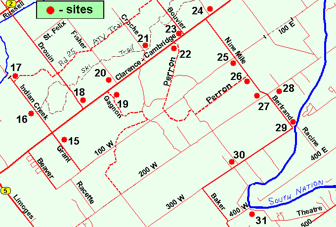 Map of the Ross Alexander Wilson Natural Area Area
Click on other site numbers to go to their pages.
Map of the Ross Alexander Wilson Natural Area Area
Click on other site numbers to go to their pages.
Site Description and Birding Information: The Ontario Ministry of Natural Resources has apparently set aside a parcel of land here as a natural area. There is a roadside sign, though no parking area, and a trail that seems not to have had any recent maintanence. It leads north from the road into second growth and cutover areas. More than that I know not. The area seems very wet, boots a necessity. Insects can be very annoying.
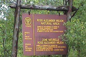 Watch for the Natural Area Sign
|
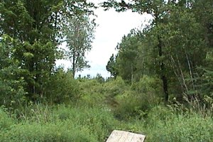 ... and the Hard to See Trail
|
Larose Forest Loop Directions: From the Ross Alexander Wilson Natural Area, drive WSW 2.2 km on Route 300W to Baker Road. Turn left or SSE onto Baker and go 1.5 km to Lacroix Road. Turn left or ENE onto Lacroix and proceed 1.0 km to the next site on this route, the Route 400 (Lacroix Road) River Access.
Return to Larose Forest Loop.
Return to Birding Ottawa Table of Contents.
|