HIGH FALLS CONSERVATION AREA
Spring: ** Summer: *** Fall: *** Winter: *
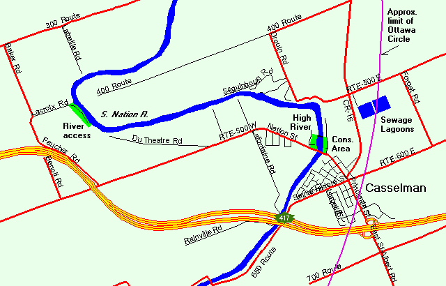
Independent Directions to this Site: From Highway 417, 53 km east of Ottawa, take exit 66 NNW toward Casselman. Go NNW 2.1 km on Main Street (Rue Principale) to the South Nation River and the High Falls Conservation Area.
Larose Forest Loop Directions: From Highway 417, 53 km east of Ottawa, take exit 66 NNW toward Casselman. Go NNW 2.1 km on Main Street (Rue Principale) to the South Nation River and the High Falls Conservation Area.
 Map of High Falls Conservation Area area
Site Description and Birding Information: This small picnic area / boat launch in Casselman provides good shorebirding when the river is low enough to expose its rocky bottom. Over a hundred Yellowlegs may be present when the river is low enough. 125 Lesser Yellowlegs were counted on July 31, 2006. Also watch for raptors when this food supply is present. Peregrine Falcon has been seen here. This section of the South Nation River can also be view from the opposite shore. In December watch here for late stragglers, such as Great Blue Heron or Belted Kingfisher.
Rare birds seen here include: Little Blue Heron (juv. Aug. 14 to at least Aug. 19, 2006), Great Egret (Aug. 3, 2008).
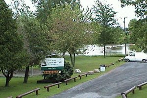 High Falls Conservation Area
|
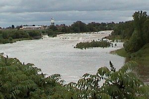 'High' Falls
|
Larose Forest Loop Directions: From High Falls Conservation Area return along Main Street (Rue Principale) 1.0 km to Laurier Street (Lemieux Road on some maps). Turn left or NNE onto it and go 1.8 km to Concession 5 Road (or Route 500). Turn right or northeast onto it and the road into the next site on this route, Casselman Sewage Lagoons is on your right almost immediately.
Return to Larose Forest Loop.
Return to Birding Ottawa Table of Contents.
|