Independent Directions to this Site: Go north on Autoroute de la Gatineau or Highway 5 as far as it has been extended (presently just west of Cascades). Take the exit road to Highway 105 and go left or north on it. Follow 105 north to Wakefield, where it joins Highway 366 (may be called Autoroute 5 here as well). Continue north on 105/366/5 for about 3 km where they part ways again. Turn left or north and continue on Highway 105 for 19 km to reach the town of Low and Chemin Martindale. Turn right or NE onto Martindale and proceed 0.6 km to Chemin Paugan (a.k.a. the Low-Poltimore Road). Turn right or east onto it.
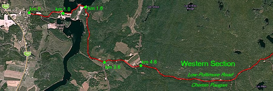
Site Description and Birding Information: This mostly gravel road, running between the towns of Low and Poltimore in the far north of the Ottawa Checklist Circle, passes through mostly forested land with a significant Boreal content. At the one kilometer mark you will reach the Paugan Dam on the Gatineau River. The road is reduced to one lane across the dam. Depending on the season you may have good but somewhat distant views of the river below the dam and the dammed reservoir to the north. You may be lucky enough to spot an Eagle (Bald or Golden) perched in the trees above the river. After passing the two sections of the dam at km 1.8, you will head into forest. It is broken by a couple of farms from km 3 to 4.6, with Chemin de Farrellton heading south at km 3.6. From the end of the farmland (km 4.6), you will find yourself in the forest for the next 12.5 km. When you reach Chemin Denholm at km 16.5, you are nearly "out of the woods".
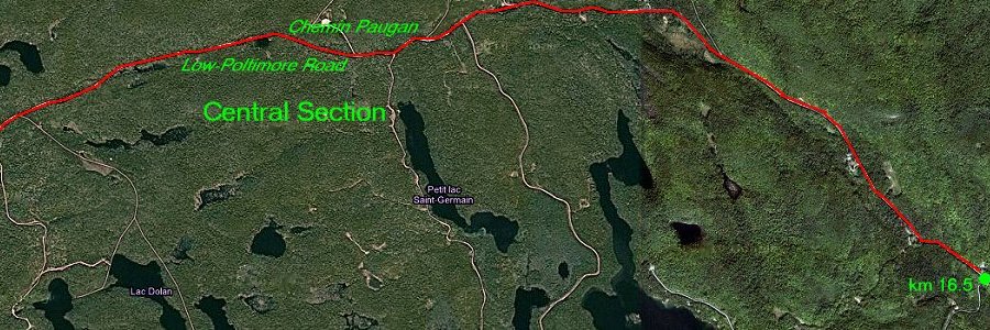
Shortly after leaving the farm area you may notice a cottage-like house on the south side of the road that has a wonderful feeding station. A quick check here may be worthwhile. This central, forested section of the Low-Poltimore Road is where Ottawa birders often go to find winter finches (including both kinds of Crossbills and Pine Grosbeaks) and boreal specialties like Black-backed and Three-toed Woodpeckers. Birding along this road can be difficult if there is much snow because safe pulloffs for stopping will be scarce. Stop only where you feel safe to do so. Traffic is usually not heavy, but there are almost always some vehicles driving this stretch.
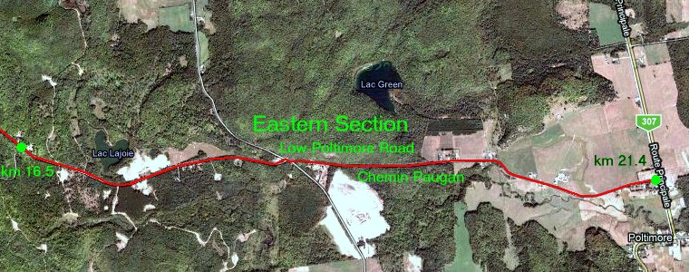
The Eastern section of the road passes through a mixed habitat of forest, field and houses. Watch for feeding stations along this section. You will reach Highway 307 or Route Principale at Poltimore 21.4 kilometres from Chemin Martindale in Low.
 |
 |