BOURGEOIS LAKE
Spring: ** Summer: ** Fall: * Winter: *
Independent Directions to this Site: From Autoroute de la Gatineau or Highway 5, take exit # 3 or Boulevard St-Raymond heading west. Travel 1.5 km west to Promenade du Lac-des-Fées and turn left or south on it. Follow Lac-des-Fées 0.4 km to Rue Gamelin and turn right or west on it. Go 0.9 km to the (Promenade de la) Gatineau Parkway and turn right or north on it. Proceed 7.5 km northwest, to the junction of the (Promenade de la) Gatineau Parkway with the (Promenade) Champlain Parkway. Turn left or WSW onto the (Promenade) Champlain Parkway and drive 6.9 km to the parking area for Bourgeois Lake.
Gatineau Park South Route Directions: From the King Mountain Trail (Black Lake) parking lot, return to the (Promenade) Champlain Parkway, turn left or west and drive 1.7 km to the parking area for Bourgeois Lake.
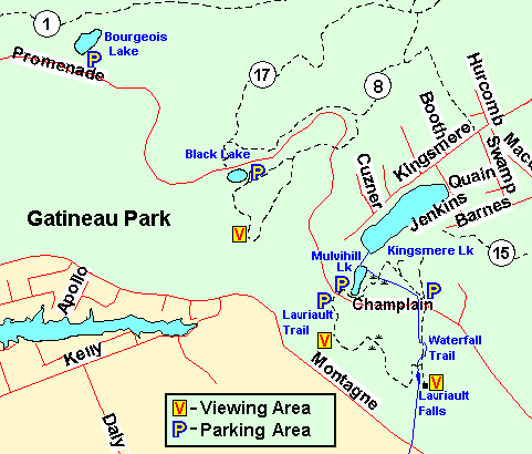 Map of the Bourgeois Lake area, Gatineau Park
Site Description and Birding Information: Bourgeois Lake is a small body of water on the righthand side of the parkway. The parking area makes it convenient to check out this area for the local breeding birds in spring and summer. In winter, this section of the parkway is closed to vehicles and is opened to skiing only. Hikers may still use the trails. The exact dates are weather dependent, but usually from mid-November to early April.
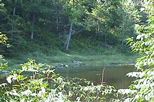
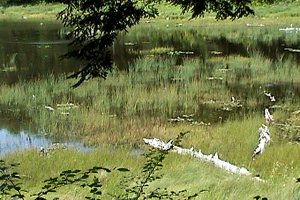 Views of Bourgeois Lake
Gatineau Park South Route Directions: From the Bourgeois Lake parking lot, return to the (Promenade) Champlain Parkway, turn right or WNW and drive 2.2 km to the parking area for the next site on this route, the Huron Lookout.
Return to Gatineau Park South.
Return to Birding Ottawa Table of Contents.
|