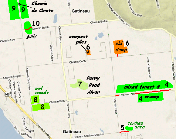
CHEMIN COOK (COOK ROAD) DUMPSITE
Spring: ** Summer: ** Fall: ** Winter: *
Independent Directions to this Site: From where Boulevard St-Raymond or Highway 148 meets Chemin Pink, take Pink Road 0.9 km westward to Chemin de la Montagne Nord. Turn right or NW onto Chemin de la Montagne Nord and proceed 2.6 km NW to Chemin Cook (Cook Road). Turn left or west onto Cook and go 3.8 km to the entrance to the Chemin Cook (Cook Road) Dumpsite.
Eardley Escarpment & Gatineau Park Northwest Route Directions: From the Chemin Antoine-Boucher east of Chemin Klock, return west to Chemin Klock (Klock Road). Turn right or north and drive 3.4 km to Chemin Cook (Cook Road). Turn right or east onto Cook and go 0.3 km to the entrance of the next site on this route, the Chemin Cook (Cook Road) Dumpsite.
 Map of the Chemin Cook (Cook Road) Dumpsite Area
Site Description and Birding Information: This was the site of a large dump in the not too distant past, where winter gull watching often provided thrills similar to the Nepean Dump. It has been retired for a number of years now, but is still included because it has overgrown field habitat that is not always easy to find. This provides potential for seedeating birds such as sparrows. The open area this near the escarpment provides good viewing for eagles and other birds of prey.
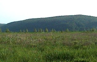 View of Chemin Cook (Cook Road) Dumpsite
|
|
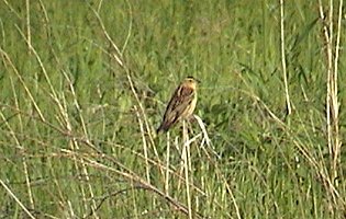 Female Bobolink in Site's Grassland
|
This facility is gated, but is seemingly open to visitors. The inspection roads can be driven, but best to ask permission. The HQ appears to be the building at the north end of the old dumpsite, hidden from view until you reach it.
When this was an active dump site (through the 1980's), a number of rarities were reported here including Laughing Gull (Oct. 15, 1983) and California Gull (Nov. 12, 1988).
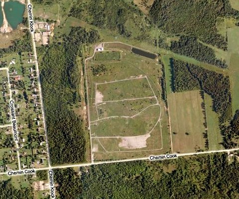 Bing Satellite Image of the Chemin Cook (Cook Road) Dumpsite Area
One kilometer west of the corner of Cook and Klock Roads is the entrance, on the right or north, to a large composting facility. It is about 300 meters north of Cook. A quick visit here might be worth the time, especially when it begins to get cold and tardy sparrows and such may stay here for food and warmth.
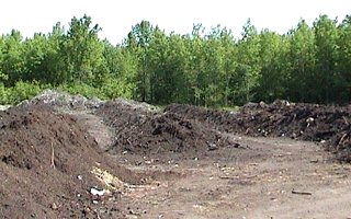 View of Chemin Cook (Cook Road) Compost Site
Eardley Escarpment & Gatineau Park Northwest Route Directions: From the Chemin Cook (Cook Road) Dumpsite entrance, return west 0.3 km on Chemin Cook to Chemin Klock. Continue west 1.0 km to the compost area entrance. If you were here, return to Cook Road and join those coming straight from the old dump. Continue west a further 1.2 km to Chemin Perry (Road). Turn left or south on Perry and drive 1.0 km to the trail (on the left or east) into the next site on this route, the Chemin Perry (Perry Road) Alvar.
Return to Eardley Escarpment & Gatineau Park Northwest.
Return to Birding Ottawa Table of Contents.
|