CHEMIN PINK (ROAD) BETWEEN CHEMINS VANIER AND KLOCK (ROADS)
Spring: ** Summer: * Fall: ** Winter: **
Independent Directions to this Site: From where Boulevard St-Raymond or Highway 148 meets Chemin Pink, take Pink Road 0.9 km westward to Chemin de la Montagne Nord. Turn left or west to continue on Chemin Pink and drive 3.0 km to Chemin Vanier (Vanier Road). Continue west on Chemin Pink (Pink Road) to bird it between Chemins Vanier and Klock (Roads).
Eardley Escarpment & Gatineau Park Northwest Route Directions: From the Sedge Wren area or the Quarry on Chemin Vanier (Road), return south on it to Chemin Pink (Road). Turn right or west on Pink to enter the next site on this route, Chemin Pink (Road) between Chemins Vanier and Klock (Roads).
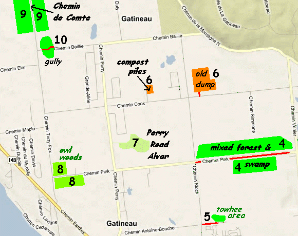 Map of the Chemin Pink (Road) between Chemins Vanier and Klock (Roads) Area
Site Description and Birding Information: This stretch of road goes through an area of mixed forest and swamps, with conifers predominating in some areas. This gives rise to the possibilities of boreal forest birds, especially in winter. Traffic is heavy and pulloffs few, so be very careful stopping along this road.
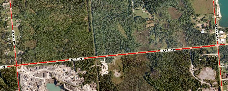 Bing Satellite View of the Chemin Pink (Road) between Chemins Vanier and Klock (Roads) Area
Birds such as Black-backed Woodpecker have been seen here on many winters.
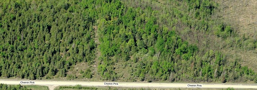 Bing Bird's Eye View of a Section of the Forest North of Chemin Pink (Road)
Eardley Escarpment & Gatineau Park Northwest Route Directions: From the Chemin Pink (Road) between Chemins Vanier and Klock (Roads), turn left or south onto Chemin Klock (Klock Road) and go 1.8 km to Chemin Antoine-Boucher. Turn left or east into Antoine-Boucher and park off to the side somewhere here. Walk 200 meters to the east to reach the next site on this route, Chemin Antoine-Boucher east of Chemin Klock (Road).
Return to Eardley Escarpment & Gatineau Park Northwest.
Return to Birding Ottawa Table of Contents.
|